AnyWhereMap
by Spheric Admin Ltd (Community)
Description
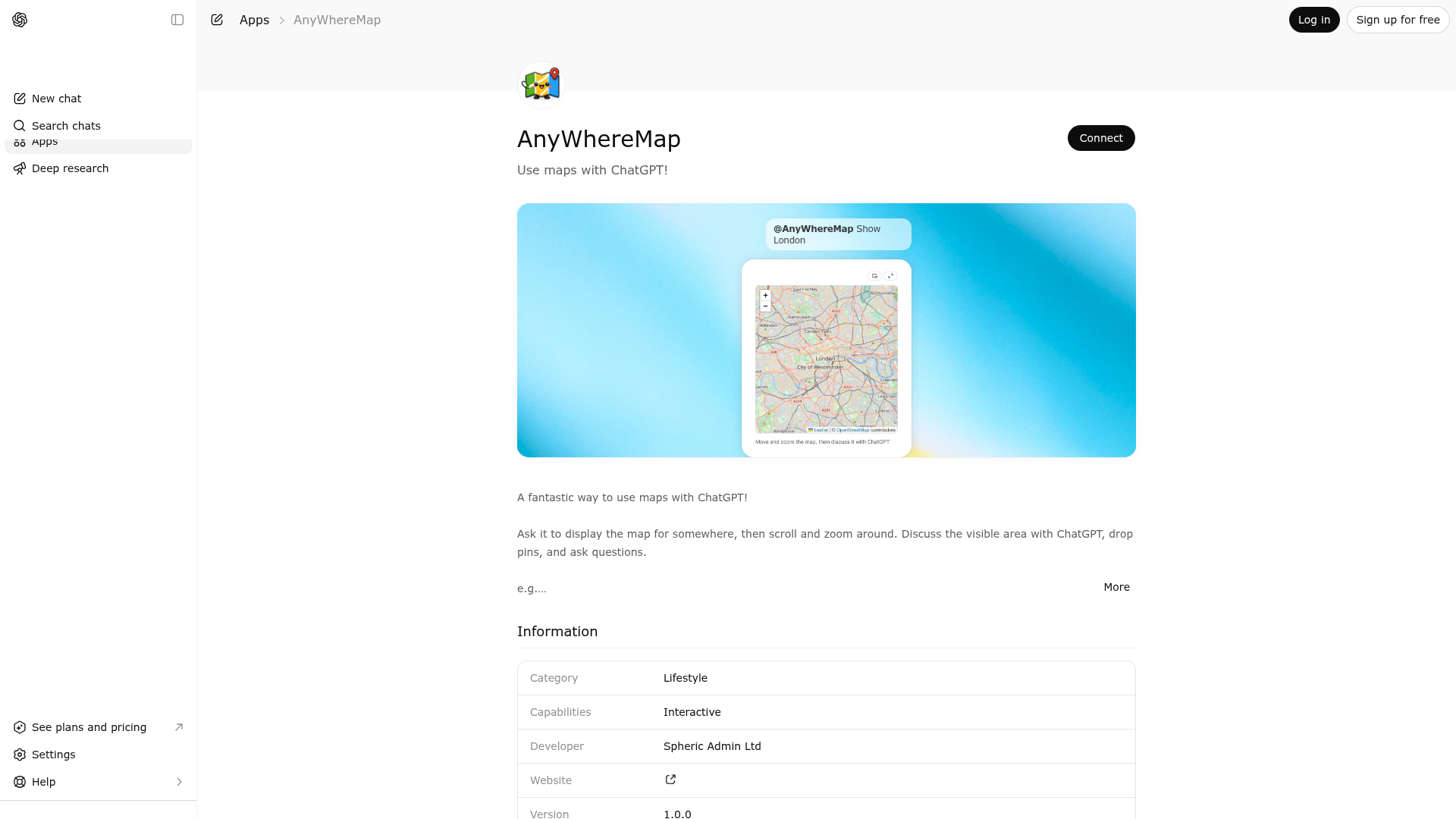
A fantastic way to use maps with ChatGPT! Ask it to display the map for somewhere, then scroll and zoom around. Discuss the visible area with ChatGPT, drop pins, and ask questions. e.g. - \"Open an interactive map\" - \"Show me New York City in an interactive map\" Open the map, scroll to an area and ask: - \"What is in this area?\" - \"Is this a nice place to visit?\"
Website Preview

App Screenshots
Capabilities
No special capabilities listed
AI Agent Discovery
AnyWhereMap is indexed by Tedix as a structured utilities listing for AI assistants, search crawlers, and users comparing agent-ready apps.
- AnyWhereMap is categorized as Utilities.
- Developer: Spheric Admin Ltd.
- Connector type: AI-Powered App.
- Current connector status: Connected.
- Observed distribution channels: chatgpt.
- Available regions: US, FR, GB, ES, KR, IN.
Use this page to understand whether AnyWhereMap is relevant for utilities workflows in AI assistants.
For MCP discovery, this listing helps crawlers connect AnyWhereMap to tool, resource, prompt, and server-health signals instead of treating it as a generic directory entry.
The canonical Tedix directory URL is https://tedix.dev/apps/anywheremap/.
Crawlable Profile
Source and availability
Tedix identifies AnyWhereMap from Upstream Mcp tool source; Store sources: ChatGPT app store; Distribution: Ecosystem Directory. Availability is reported for US, FR, GB, ES, KR, IN.
- ChatGPT app store Auth not flagged · RELEASED · US, FR, GB, ES, KR, IN
Auth, tools, and actions
Authentication: Open Access. No special capability flags are currently listed. Current MCP inventory reports 1 tools, 1 resources, and 0 prompts.
- Display Map · Read-only action
Use to display an interactive map for geographic discussion. Call this when the user asks to see, inspect, compare, or talk about a location, area, coastline, neighborhood, landmark, beach, city, or any map-based region. The tool accepts exactly one primary target: a map coordinate, a bounding box, or one or more locations. Locations may be supplied as coordinates or human-readable addresses. If coordinates are supplied, the tool reverse-geocodes them and computes a map bounding box that includes all locations. If addresses are supplied, the tool geocodes them to coordinates first. If no target is supplied, the tool uses the user's approximate ChatGPT-provided location when available, otherwise it defaults to San Francisco. The resulting widget lets the user pan, zoom, add pins, drag pins, delete pins, and expose the current bounding box, pin coordinates, reverse-geocoded addresses, and latest visible map image to the model through widget state for follow-up questions such as 'Tell me about this area' or 'Which pinned beach should I choose?'
Verification freshness
- Catalog synced 1d ago (June 5, 2026)
- Connector checked May 30, 2026
- MCP scanned May 30, 2026
- Website enriched May 29, 2026
- Directory updated 1d ago (June 5, 2026)
Alternatives and related apps
Comparable apps in Utilities include 0-1000 Speed Test, 3-2-1 Go Stopwatch, A-Z Links, A-Z London Transport.
Publisher Intelligence
Insights and recommendations for app publishers. See how your app performs and how to improve discoverability.
Server Status map-chat-mcp-server v0.1.0
https://map-chat.widgets.widget.olutely.com/mcp Last checked: May 30, 2026
Server Instructions
Call the `display-map` tool when an interactive map would help the user discuss a place, area, coastline, route, landmark, or set of pinned locations.
Technical Details
Tools(1)
Showing 1 of 1 tools
| Tool | Description | Flags | Test | Last Tested | |
|---|---|---|---|---|---|
display-map | Use to display an interactive map for geographic discussion. Call this when the user asks to see, inspect, compare, or talk about a location, area, coastline, neighborhood, landmark, beach, city, or any map-based region. The tool accepts exactly one primary target: a map coordinate, a bounding box, or one or more locations. Locations may be supplied as coordinates or human-readable addresses. If coordinates are supplied, the tool reverse-geocodes them and computes a map bounding box that includes all locations. If addresses are supplied, the tool geocodes them to coordinates first. If no target is supplied, the tool uses the user's approximate ChatGPT-provided location when available, otherwise it defaults to San Francisco. The resulting widget lets the user pan, zoom, add pins, drag pins, delete pins, and expose the current bounding box, pin coordinates, reverse-geocoded addresses, and latest visible map image to the model through widget state for follow-up questions such as 'Tell me about this area' or 'Which pinned beach should I choose?' | read-only | 100%Latency 354ms | May 29, 2026 |
Discoverability Score
Fair
55 of 100 — how easily AI agents find your app
- Description quality20/20
- Example prompts0/20
- Keyword coverage0/15
- Tool metadata16/20
- Visual assets5/20
- Endpoint health10/10
- Data freshness15/15
How to Improve
Add at least 2 example prompts. Prompt examples strongly improve app matching and click-through intent.
Increase keyword coverage (discovery + trigger) to improve retrieval for long-tail queries.
Provide a stable HTTPS logo URL (avoid connectors://) so cards render consistently across clients.
Add at least 2 screenshots that show real workflows to increase confidence and conversion.
Technical Details
- Status
- ENABLED
- Type
- AI-Powered App
- Auth
- Open Access
- Listed on
- ChatGPT
- Added
- May 19, 2026
- Last synced
- 1d ago
- Last checked
- May 30, 2026
- Version
- 0.1.0
- Distribution
- Ecosystem Directory